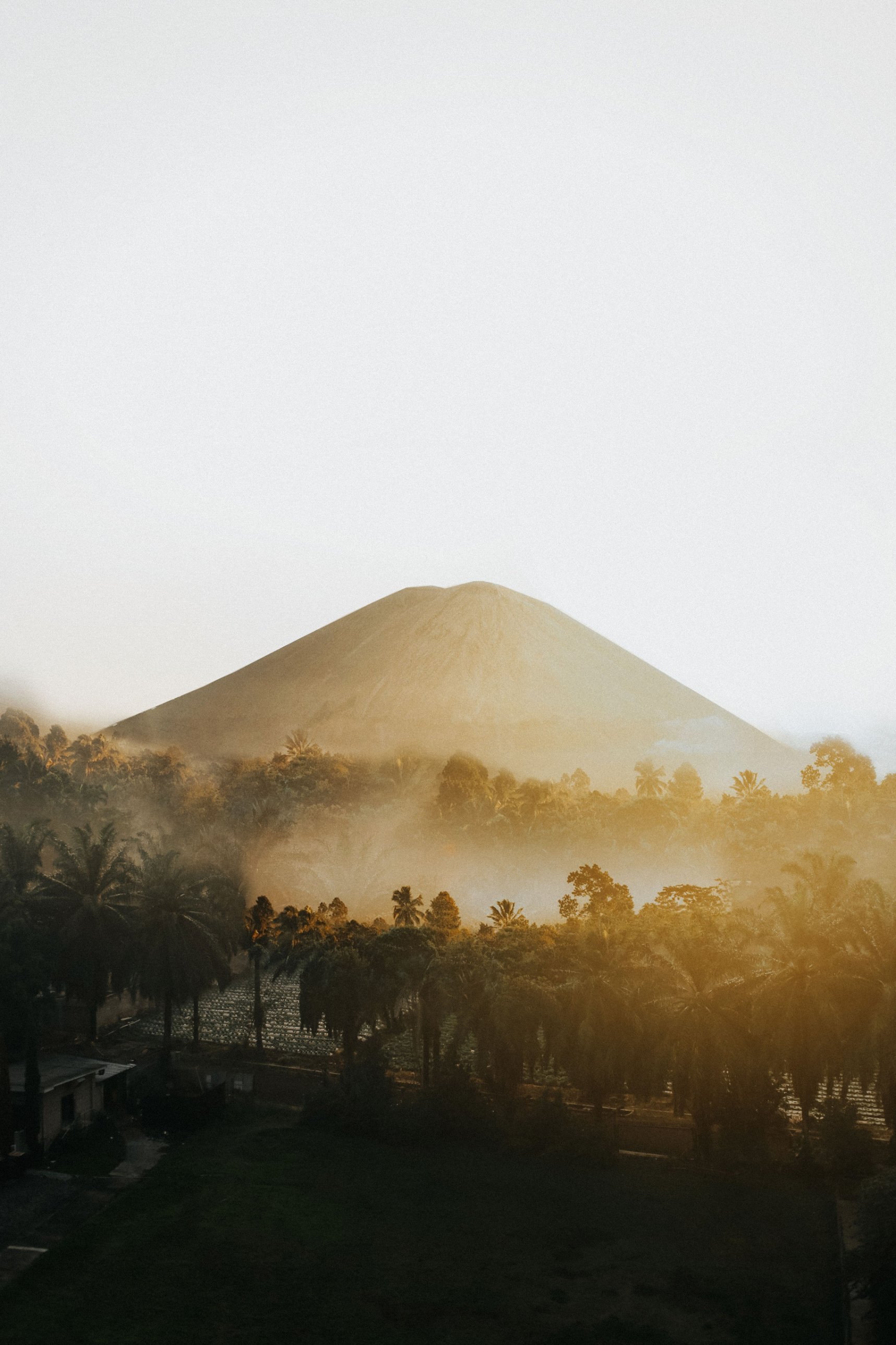
In April 1815 a mountain on Sumbawa tore itself apart in the largest eruption in recorded history, and the following year much of the northern hemisphere lost its summer. What remains is a flat-topped giant with a caldera about 6 km wide, protected since 2015 as Tambora National Park and climbed by a small but growing number of trekkers.
What is Tambora National Park?
Tambora National Park (Taman Nasional Tambora) protects Mount Tambora, the volcano on Sumbawa's Sanggar Peninsula whose 1815 eruption was the most powerful in recorded history. President Joko Widodo inaugurated the park at Doro Ncanga on 11 April 2015, the 200th anniversary of the eruption. It covers 71,644 hectares across Dompu and Bima regencies in West Nusa Tenggara.
The park takes in the whole mountain, from the dry savanna on its southern foot through lowland and montane forest to the bare caldera rim. When it was created, the protected land was made up of a nature reserve of 23,840 ha, a wildlife reserve of 21,674 ha known for its birds, and a hunting park of 26,130 ha. Today the summit stands at about 2,850 m, roughly a third lower than before the eruption.
What happened when Tambora erupted in 1815?
Tambora rumbled from 1812, began a major eruption on 5 April 1815 and reached its climax on the evening of 10 April. Scientists rate it VEI 7, with roughly 37 to 45 km³ of magma thrown out. Estimates of the dead range from at least 71,000 to around 100,000 people, most of them from the famine and disease that followed.
The explosions were heard in Makassar and Batavia, and reportedly as far away as Sumatra. Ash and sulphur in the stratosphere cooled the planet, and 1816 became the "year without a summer": snow and frost fell in New England and Quebec in June, and harvests failed across Europe and North America.
The collapse left a caldera about 6 km wide. Sources give its depth as anything from about 600 m to more than 1 km, depending on where it is measured. A small cone on the caldera floor, Doro Afi Toi, marks later, much smaller activity.
Who lived on Tambora before 1815?
The slopes were home to small kingdoms, among them Tambora itself, and the eruption wiped them out. In 2004 a team led by volcanologist Haraldur Sigurdsson of the University of Rhode Island, working with Indonesia's Directorate of Volcanology, excavated a buried village west of the caldera, which the press soon called the "Pompeii of the East".
Under about 3 m of ash and pumice they found a house raised on stilts, bronze bowls, pottery and the carbonised remains of two adults. The team concluded that the people of Tambora were fairly prosperous, and suggested that their language, now lost, was related to the Mon-Khmer family of mainland Southeast Asia. Today villages such as Pancasila sit on the northwestern slope, surrounded by coffee plantations.
Which Tambora trekking route should you choose?
The park recognises four official routes: Pancasila and Doro Ncanga in Dompu Regency, and Kawinda Toi and Piong in Bima Regency. Pancasila is the classic walking route and the busiest; Doro Ncanga and Piong can be driven partway by off-road vehicle. Most treks take two days with a night on the mountain.
The Pancasila route starts from the village on the northwestern side, where climbers register. The trail climbs through old coffee gardens and forest past five numbered posts, with water near the lower posts, and many groups camp at Pos 3 before a pre-dawn push to the rim. Trekkers report about 8 to 9 hours of walking from the trailhead, and the true summit lies on the western rim.
From Doro Ncanga on the south coast, 4x4 vehicles and trail bikes can carry climbers across the savanna, sometimes as far as Pos 3 at roughly 1,800 m, conditions permitting. From there it is a few hours on loose ash and gravel to a lower section of the rim, with wide views into the caldera. There is no water on this route, so carry all you need.
Kawinda Toi and Piong, on the Bima side of the mountain, see fewer climbers than Pancasila. Oi Marai waterfall, also in Bima Regency, is the park's main non-trekking attraction. Four unofficial routes were closed by the park in October 2025, so use only the official ones.
What is the Doro Ncanga savanna like?
Doro Ncanga is a wide, open grassland on the southern foot of the volcano, running down towards the sea. It is the most accessible part of the park, and the place where the park was inaugurated in 2015. Horses graze freely here, and the park runs a deer sanctuary at its Doro Ncanga resort.
The savanna is golden and dry for much of the year, which makes it beautiful but flammable. Fires in early September 2026 burned an estimated 834 ha in three parts of the park, including along the Kawinda Toi trail, and the park suspects illegal hunting of Timor deer and land clearing as causes.
Is Tambora still active, and is it safe to climb?
Tambora is an active volcano, but it is not erupting. Indonesia's Geological Agency raised it from Level I (Normal) to Level II (Waspada) on 10 March 2026 after a rise in deep volcanic earthquakes, and official lists in September 2026 still showed Level II. Check the current level on MAGMA Indonesia before you go.
Under Level II, nobody may descend to the caldera floor or approach the cones Doro Afi Toi and Doro Afi Bou or the gas vents, and people are told to stay at least 3 km from the centre of activity. Rockfalls from the caldera walls can happen at any time. The park's advice is simple: if you smell strong sulphur, see smoke, or hear rumbling, go down at once without waiting for instructions.
The other risks are ordinary mountain ones: heat and dehydration on the exposed lower slopes, cold and wind on the rim, and holes and drop-offs above Pos 3 on the Doro Ncanga route. Stay well back from the rim edge.
When is the best time to visit Tambora?
Go in the dry season, roughly May to August, and confirm that the trails are open before you travel. The park closes all routes in extreme weather and in periods of high fire risk, and in 2026 both happened.
The trails were closed from 28 December 2025 and reopened on 14 April 2026. They closed again on 1 September 2026 because of fire risk at the peak of the dry season, with no end date announced. As of late October 2026 we found no announcement that they had reopened, although Oi Marai waterfall remained open. In the wet months, roughly December to April, the lower trails are muddy and slippery and closures are likely.
How do you get to Tambora National Park?
The usual gateway is Bima's Sultan Muhammad Salahuddin Airport (BMU), followed by a drive of about 3 to 4 hours via Dompu to Pancasila. Citilink has flown from Lombok since 2023, and TransNusa launched direct flights from Bali in December 2025; schedules change, so check them before you book.
Overland from Lombok, ferries cross to Poto Tano on western Sumbawa, followed by a long drive east. Sumbawa Besar is the other access point: from the nearby port of Badas, chartered boats take about 6 hours across Saleh Bay to Calabai, which is under an hour by road from Pancasila. There is little reliable public transport to the trailheads, so most visitors arrange transport through a local guide or operator.
What does it cost to climb Tambora?
You pay a national park entrance fee per day, plus the cost of a mandatory local guide or porter, transport and food. The park has no online booking system, and climbers register in person at the park post at the trailhead. Fees and guide rates have changed several times, so check current prices with the park office or your guide before you go.
Climbers must register and sign a statement of responsibility, bring a health certificate, and follow the park's zero-waste rule. There are no banks on the mountain, so bring enough cash for fees, guides and porters, with some reserve in small notes.
How to visit Tambora responsibly
Use only official routes and licensed local guides and porters, which keeps rangers able to reach you and money in the villages. Carry all rubbish back down, never light fires on the savanna or in the forest, and do not buy wild deer meat. Respect the caldera restrictions, and remember that this whole mountain is a grave for the people of 1815.